
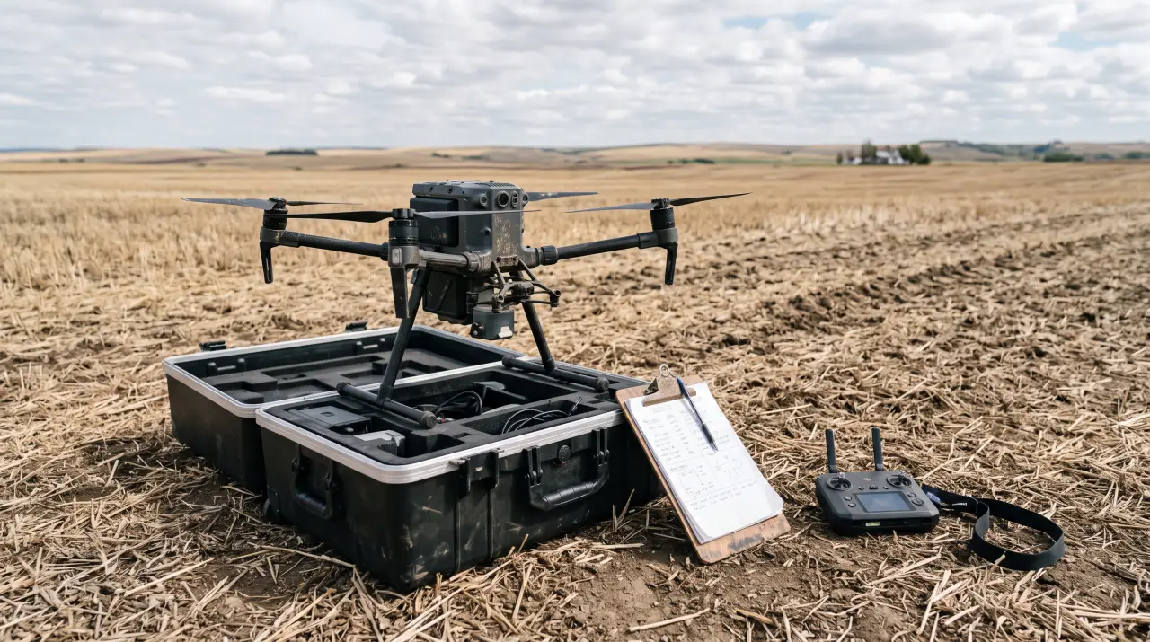
A drone is one of the few pieces of farm technology where the hardware is the easy part. A capable mapping quadcopter with a multispectral sensor can be ordered for the price of a decent yield monitor cable, and a 40-liter spray drone with RTK guidance is now competitive on a per-acre basis with a custom applicator over short windows. The regulation, however, is the part that catches operators by surprise. The Federal Aviation Administration treats every commercial drone flight as an aircraft operation, with paperwork, pilot certification, and a stack of operating rules that do not match the way most farmers think about flying something over their own field. Get the rules wrong and the consequences range from a strongly worded letter to civil penalties that start at several thousand dollars per violation and scale up fast for spray operations.
This guide is the practical version of that picture for working farms in 2026. It covers what Part 107 actually requires, the difference between recreational and commercial flight when the drone is over your own ground, where the line is between mapping work and spraying work, the waivers that matter for agriculture, the new Remote ID requirements and how to comply without buying new hardware, the special rules for spray drones over 55 pounds, and the practical compliance setup that keeps a farm operation legal without hiring a flight department. If you are scouting your first drone purchase, considering a spray rig, or trying to figure out whether your existing setup is actually legal, the rules are stricter than most people think but more workable than they sound.
Every drone flight in the United States falls into one of three regulatory regimes, and the first job is figuring out which one applies to a given flight on your farm. The buckets are not about who owns the land or who owns the drone. They are about the purpose of the flight.
The first bucket is recreational flight under 49 USC 44809. This is the carve-out for hobby flying, and it is narrower than people assume. To qualify, the flight must be strictly for personal enjoyment, the pilot must follow the safety guidelines of a community-based organization like the Academy of Model Aeronautics, and the pilot must have passed the TRUST - The Recreational UAS Safety Test - which is free and takes about 30 minutes online. Recreational flight is fine for flying your kid's quadcopter around the back yard. It is not the right framework for any flight that supports the business of the farm, including taking pictures of the crop, mapping a field, or scouting for pests, even if you happen to enjoy doing it.
The second bucket is Part 107, the small unmanned aircraft rule. This is the regime that covers virtually all commercial drone work, including all agricultural mapping, scouting, photography for marketing, livestock monitoring, infrastructure inspection, and aerial work for hire. To fly under Part 107 you need a remote pilot certificate, which requires passing a 60-question knowledge test at an FAA-approved testing center and passing TSA vetting. The drone itself must weigh less than 55 pounds at takeoff including payload, must be registered with the FAA, and must comply with Remote ID. The flight rules under Part 107 are specific - daylight or civil twilight unless waivered, visual line of sight unless waivered, below 400 feet above ground level, not over moving vehicles or non-participants without specific exceptions, and within 4 statute miles of unmanned terrain in controlled airspace only after authorization. Most farm drone flights live entirely inside Part 107.
The third bucket is Part 137, the agricultural aircraft rule. This was originally written for crop dusters and turbine helicopters, and it is now the regime that covers spray drones. Any drone operation that disperses an economic poison - which the FAA defines broadly to include herbicides, pesticides, fungicides, and many fertilizer formulations - has to operate under Part 137. Part 137 requires an agricultural aircraft operator certificate, which is a separate FAA certificate from the Part 107 remote pilot certificate. The applicant has to pass a knowledge test on dispensing operations, demonstrate the operation to an FAA inspector, and accept ongoing record-keeping obligations. We will get to the spray drone specifics later because they deserve their own treatment.
Knowing which bucket a flight falls into is the first decision because the rules diverge from there. A flight that is fine under recreational rules might be illegal under Part 107, and a flight that is fine under Part 107 might be illegal under Part 137. The safest default for any farm-related flight is to assume Part 107 applies and work down from there.
The remote pilot certificate is the gating credential for everything else, so it is worth being clear about what is involved.
The knowledge test is 60 multiple-choice questions covering airspace classification, weather, sectional charts, aircraft loading and performance, emergency procedures, crew resource management, radio communications, and aeronautical decision-making. The test draws heavily from the same body of knowledge as the private pilot written test, which catches a lot of farmers off guard. Reading a sectional chart, decoding a METAR, and working out a relative wind for a takeoff calculation are all on the test, and none of it is intuitive without study.
The good news is that the test is not designed to be a barrier. The FAA publishes the entire knowledge testing supplement, including all the charts and figures the test draws from, as a free PDF. Several test prep companies - Pilot Institute, Drone Pilot Ground School, King Schools, RemotePilot101 - offer 8 to 16 hour video courses for $150 to $300 that cover everything on the test in plain English with practice questions. A motivated farmer with no aviation background can pass the test cold in two to three weekends of evening study. The test costs $175 at any FAA-approved testing center, which exists in most cities. A passing score is 70 percent.
After passing the test, you submit FAA Form 8710-13 through the IACRA system, undergo TSA vetting, and receive a temporary certificate by email within a few weeks and a permanent certificate by mail within a few months. The certificate has to be renewed every two years through a free online recurrent training course called ALC-677, which is much shorter and easier than the initial test. There is no flight test for Part 107.
A practical note for multi-operator farms - the certificate is held by the individual pilot, not the operation. If three people on the farm fly drones, each needs their own certificate. There is no shared or commercial-entity license for small drones. A single certified pilot can supervise visual observers and trainees during a flight, but the pilot in command has to hold the certificate and has to be physically present.
Every Part 107 drone has to be registered with the FAA. Registration costs $5 per drone, lasts three years, and is done through the FAA DroneZone portal. The registration number gets marked on the airframe, usually with a label maker on the inside of a battery bay. This step is straightforward and is not where people get tripped up.
The harder requirement is Remote ID, which became enforceable in March 2024. Remote ID requires every drone operating under Part 107 to broadcast an identifying signal during flight, including the drone's serial number, position, altitude, velocity, control station location, and a timestamp. The signal is received by anyone with a compatible app and is intended primarily for law enforcement and air traffic management.
There are three ways to comply. Most drones manufactured after September 2022 from major brands like DJI, Autel, and Skydio have Standard Remote ID built into the airframe and broadcast automatically over Bluetooth or WiFi without any user action. Older drones can be retrofitted with a Broadcast Module that bolts on and adds Remote ID to a non-compliant airframe; modules cost $100 to $300 and are available from Dronetag, Bluemark, and others. The third option is to fly only at FAA-Recognized Identification Areas, which are designated locations - mostly model aircraft fields - where Remote ID is not required. The FRIA option is not useful for farm work because farm fields are not FRIAs.
The practical impact for farmers is mostly painless if your drone is recent. A 2023 or later DJI Mavic, Phantom, or Matrice is compliant out of the box. An older drone may need a $200 module or may need to be replaced. A homebuilt drone or a drone you assembled from parts requires a Broadcast Module. The penalty for flying without Remote ID is up to $27,500 per violation, although enforcement to date has focused on egregious cases rather than rural agricultural operations.
A subtle point worth flagging - Remote ID broadcasts your control station location, which means a remote ID receiver near your field can see exactly where the operator is standing. This has not been a privacy issue in farming contexts but is worth understanding.
Once a pilot has the certificate and a registered Remote ID-compliant drone, the operating rules of Part 107 control how the drone can be flown. Most of these rules are sensible, several of them are not intuitive in a farm context, and a few are routinely violated by operators who do not know they are violating them.
Daylight or civil twilight is the standard. Flight is allowed from 30 minutes before sunrise to 30 minutes after sunset without a waiver, provided the drone has anti-collision lights visible for 3 statute miles during civil twilight. Night operations beyond civil twilight require either anti-collision lighting and updated knowledge testing under the 2021 night flying provisions, or a 107.29 waiver. Most current drones have built-in anti-collision lights and most current Part 107 certificates include the night-flight knowledge update.
Visual line of sight is the rule that creates the most operational friction on a farm. The pilot in command, or a designated visual observer in radio contact, has to be able to see the drone with unaided vision throughout the flight. On a half-section field, the far corner is well beyond the range of unaided vision for most people, especially for a small drone. The legal answer is that the pilot has to walk or drive to maintain visual contact, or station observers across the flight path. The illegal but common answer is to fly the entire field from the truck. BVLOS - Beyond Visual Line of Sight - operations are theoretically allowed under a 107.31 waiver, but the waiver process has historically been demanding. The FAA has been gradually loosening BVLOS, and a Part 108 framework specifically for BVLOS is in late-stage rulemaking, with a final rule expected in 2026 or 2027. Until then, most farm operations either fly within visual range or use multiple takeoff points to cover a large field.
The 400-foot AGL altitude ceiling is rarely an issue for agricultural mapping flights, which typically run at 100 to 300 feet. The exception is around tall structures - 107 allows flight up to 400 feet above the structure within a 400-foot lateral radius, which is useful for grain leg or cell tower inspection.
Flight over moving vehicles is restricted unless the vehicle is participating in the operation, the area is restricted to participants, or the drone is operated under specific operations-over-people rules. On a farm this means a drone cannot legally fly over a county road during traffic, even briefly. Many farm flights cross or transit roads, and the legal handling is to either pause the flight while a vehicle passes or to fly along the road rather than across it. Flight over the operator's own moving tractor or sprayer is allowed because the vehicle is participating.
Operations over people without a 107.39 waiver require the drone to be classified into one of four FAA categories based on injury risk if the drone hits a person. Category 1 drones weigh less than 250 grams and have no exposed rotating parts that can lacerate skin - sub-250-gram drones from DJI and Autel qualify. Categories 2 through 4 require formal certification by the manufacturer with documented injury testing. For a farmer working alone or with a small crew, the operations-over-people question rarely comes up. For weddings and public events, it dominates the planning.
Controlled airspace authorization is required for any flight in Class B, C, D, or surface-area E airspace. This is where the LAANC system - Low Altitude Authorization and Notification Capability - becomes relevant. Most farms are in Class G airspace and do not need authorization. Farms within five miles of a controlled airport need to check the sectional chart and request LAANC authorization through an approved app like Aloft, AirHub, or Skyward. Authorization usually comes back within seconds for routine altitudes. Farms near military operating areas, restricted areas, or temporary flight restrictions need to check NOTAMs before each flight; TFRs around presidential travel and major sporting events show up unpredictably.
A subtle category many farmers miss is the National Security UAS Restriction Areas around military installations and certain federal facilities. These were rolled out under the Special Security Instructions framework and are not always shown on consumer drone apps. Check the FAA UAS Data Delivery System or the B4UFLY app before flying anywhere within 30 miles of a military base.
Part 107 includes a waiver process for operations outside the standard rules. A waiver is requested through the DroneZone portal, requires the operator to demonstrate an equivalent level of safety, and is granted for a specific operator and operation. Some waivers are routine and granted in days; others take months or are flatly denied.
The waivers that matter for farm operations are concentrated in a few categories.
Beyond Visual Line of Sight - 107.31 - is the holy grail for large operations. With BVLOS approval, a farm could fly a single drone across an entire section without repositioning the operator. Historically the BVLOS waiver process required extensive operating manuals, mitigation analyses, and sometimes deployed observers or detect-and-avoid technology. As of 2026, the bar is lower for shielded operations - flying low over open ground with no people and no other aircraft - and the upcoming Part 108 rule is expected to formalize this with a streamlined application path. A handful of agriculture-focused operators have BVLOS waivers in place today; the rest are waiting for Part 108.
Night operations - 107.29 - is no longer needed for most cases because the 2021 night-flying provisions allow night flight with anti-collision lights and updated training. A waiver is only needed for night operations that combine with other waiver categories.
Operations over people - 107.39 - matters for operations like aerial photography of farm tours, agritourism events, and any flight where customers or visitors are present. The Category 1 path - sub-250-gram drone - is the easiest. Anything larger needs either a Category 2-4 certified drone or a specific waiver.
Operations from a moving vehicle - 107.25 - allows flight from a moving truck or tractor. This is genuinely useful for farm work, particularly for following livestock, monitoring application equipment, or covering large distances. The waiver is not commonly granted for use over densely populated areas but is regularly granted for sparsely populated rural settings. The application has to describe the vehicle, the speed, the operator's communication setup, and the recovery plan if the drone is lost.
Operations over multiple drones from a single pilot - 107.35 - allows one pilot to operate more than one drone simultaneously, which becomes interesting for swarm spraying and coordinated mapping. As of 2026 these waivers exist but remain uncommon.
The waiver application is free, but the analytical work behind a credible application is real. A farmer who needs a complex waiver - particularly BVLOS - usually contracts with a consultancy that specializes in Part 107 waiver writing for $2,000 to $10,000 in legal and engineering work. For the more routine waivers, a careful applicant can self-prepare in a weekend.
Spray drones occupy an entirely separate regulatory universe and deserve a dedicated section because the rules are non-obvious and the penalties for getting them wrong are large.
Any drone that disperses an economic poison - including herbicides, pesticides, fungicides, defoliants, plant growth regulators, and certain fertilizers - is regulated as an agricultural aircraft under 14 CFR Part 137. This applies regardless of weight, regardless of who owns the chemical, and regardless of whether the drone is being operated for hire. A farmer spraying his own field with his own glyphosate has to comply with Part 137.
The compliance stack for a Part 137 drone operation includes:
The 55-pound threshold is the dividing line between Part 107 and a heavier-aircraft regime. A typical 30-liter spray drone weighs roughly 70 to 90 pounds with a full tank. That puts it over the 55-pound Part 107 ceiling and triggers a 44807 exemption requirement, which used to take months and is now granted relatively routinely for the common spray drone models like the DJI Agras T40 and T50, the XAG P100, and the Hylio AG-272 within a few weeks of application.
The state-level overlay is the part that frequently surprises operators. Every state has its own pesticide applicator licensing program, and as of 2026 most states have added drone-specific endorsements, training requirements, or buffer zone rules on top of federal requirements. California, Washington, Oregon, and several Northeastern states have particularly strict drone spray rules. Texas, Iowa, Nebraska, and most of the Plains states are more permissive. The state department of agriculture is the relevant regulator and the rules change yearly. Check before you fly.
Pesticide labels themselves are evolving. The EPA has been updating product labels to address aerial application from drones specifically, and some products now include drone-specific droplet size, swath width, buffer zone, and wind speed restrictions that differ from the manned aerial application rules. A label that allowed aerial application from manned aircraft last season may have new drone-specific restrictions this season. The label is the law - if the label restricts drone use, drone application is illegal regardless of FAA rules.
The bottom line for spray drone operations - the legal, paperwork, and training overhead is roughly equivalent to becoming a small custom applicator. For a farmer planning to spray a few hundred acres of his own ground, the math sometimes works and sometimes does not. For a farmer planning to spray for hire, the math has to include a meaningful business overhead for compliance.
A Part 107 operation does not legally require insurance. The FAA does not check for it. Practical reality is different. The downside risk on a farm drone operation includes prop strikes that injure people, fly-aways that hit structures or vehicles, chemical drift damage from spray operations, and the accumulating risk of cumulative exposure across a season. A meaningful liability event without insurance can wipe out an operation.
Two insurance products matter. Hull coverage on the drone itself is sold by drone-specific insurers like SkyWatch and BWI for a few hundred dollars per year on a $5,000 mapping drone, scaling up to a few thousand per year for a fully outfitted spray drone. Liability coverage, which protects against third-party injury and damage, is typically $1 to $5 million per occurrence and runs $400 to $1,500 per year for mapping operations and $2,000 to $5,000 per year for spray operations. Most commercial farm policies do not automatically cover drone operations, and many specifically exclude them. Check with the agent and add a rider if needed.
A practical compliance setup for a typical farm drone operation looks like this. One or two operators hold Part 107 certificates with current recurrent training. Each drone is registered with FAA and Remote ID compliant. A simple flight log tracks each flight with date, location, duration, pilot, weather, and any anomalies. A pre-flight checklist that takes 5 minutes is followed before every flight, including battery check, calibration, weather, and airspace verification through B4UFLY. Photos and maps are stored with EXIF metadata intact for any flight that may later be relevant for an insurance claim or audit.
For spray operations, add a daily Part 137 dispensing log with chemical, rate, location, weather, and operator. Add an annual review of pesticide labels and state regulations. Add detailed maintenance records on the drone and dispensing system. The paperwork is real but routine.
Three regulatory shifts worth tracking over the next 18 months will significantly change the day-to-day reality of farm drone operations.
The first is Part 108, the long-awaited BVLOS rule. The FAA published a notice of proposed rulemaking in 2024 and a final rule is expected by late 2026 or early 2027. Part 108 is expected to create a streamlined certification path for BVLOS operations in low-risk environments, including agricultural fields, with reduced waiver requirements. For mapping operations, this is the difference between covering a section in two flights versus eight, and the difference between needing observer crews versus running a single pilot. The economic impact on large operations is meaningful.
The second is the gradual federalization and standardization of state-level pesticide rules for drones. Several states have set up working groups with the EPA to harmonize drone-specific pesticide labeling, and the EPA is moving toward a national framework that would replace the current patchwork. This will simplify compliance for operators who work across state lines.
The third is the maturation of UTM - UAS Traffic Management - infrastructure. The current LAANC system handles airspace authorization but does not actually deconflict drone traffic. The next generation, in pilot programs in several states, will provide real-time traffic deconfliction between drones and between drones and manned aircraft. For agriculture this is a non-issue today because density is low. For commercial drone delivery and BVLOS operations, it is the foundation of safe scaling.
The composite picture is that drone regulation in agriculture is becoming more permissive and more workable, not less. The basic Part 107 framework will remain. The waiver and exemption process for advanced operations - BVLOS, heavy spray drones, swarm operations - is being streamlined. The compliance overhead for a small mapping operation is modest and falling. The compliance overhead for a spray operation is substantial but manageable. If you have been holding off on a drone purchase because the regulation seems overwhelming, the framework is more navigable than it looks, and the trajectory is in the operator's favor.
The practical advice if you are starting from zero is straightforward. Get the Part 107 certificate first, before buying the drone, so the certification timeline is not on the critical path. Buy a drone that is current generation and Remote ID compliant out of the box. Insure the operation properly. Keep a simple flight log. If spraying is in the plan, treat the Part 137 stack as a separate project with its own timeline and budget. And keep an eye on Part 108 - by the time it lands, the operating model for mapping at scale will have meaningfully changed.
Yes, for any flight that supports the business, including mapping, pest scouting, livestock monitoring, or marketing photos, even over your own ground. That work falls under Part 107 and requires a remote pilot certificate. You pass a 60-question knowledge test at an FAA-approved center, costing $175 with a 70 percent passing score, then register the drone for $5. The recreational carve-out does not cover farm-business flights.
Spray drones fall under Part 137, the agricultural aircraft rule, because they disperse economic poisons like herbicides and pesticides. Compliance stacks a Part 137 operator certificate, a knowledge test, and an FAA inspector demonstration on top of the Part 107 pilot certificate. A typical 30-liter spray drone weighs 70 to 90 pounds full, over the 55-pound limit, so it also needs a 44807 exemption, plus state applicator licensing.
Remote ID, enforceable since March 2024, requires every Part 107 drone to broadcast an identifying signal in flight: its serial number, position, altitude, velocity, control-station location, and a timestamp. Drones built after September 2022 from DJI, Autel, and Skydio comply out of the box. Older airframes need a bolt-on Broadcast Module costing $100 to $300. Flying without it risks penalties up to $27,500 per violation.
Part 107 caps flight at 400 feet above ground level, though agricultural mapping typically runs at 100 to 300 feet. Near a tall structure like a grain leg or cell tower, you may fly up to 400 feet above the structure within a 400-foot lateral radius. You must also keep the drone in unaided visual line of sight and fly in daylight or civil twilight unless you hold a waiver.
Join our list for practical guides on farm tech, precision agriculture, and tools that work.