
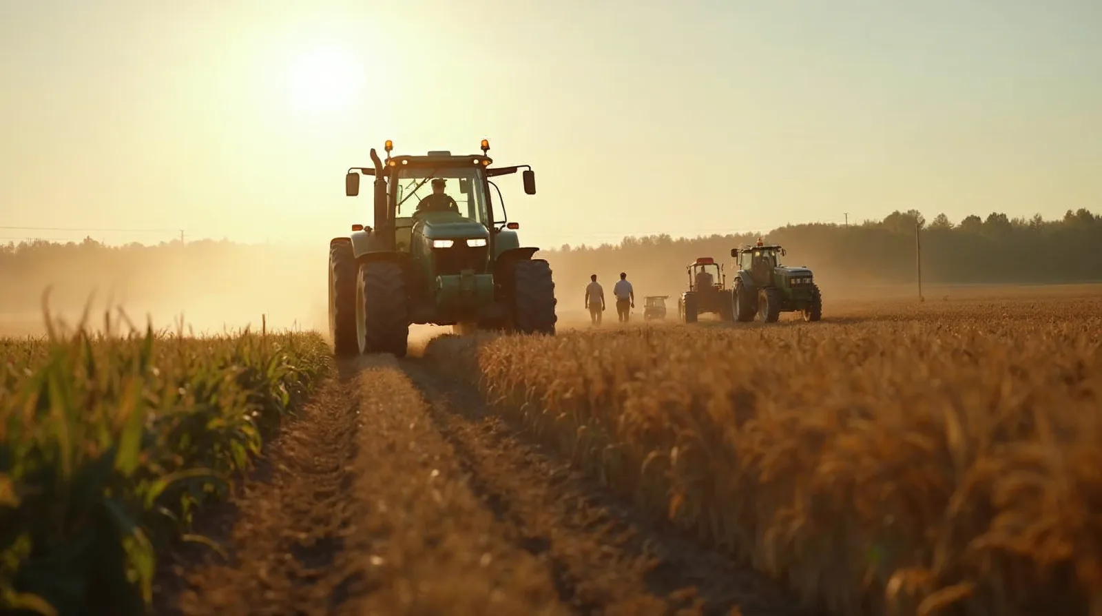
Sub-inch GPS guidance used to be a feature reserved for the biggest operations with the biggest iron. A factory RTK subscription from a green dealer, a yellow dealer, or a red dealer could run two to three thousand dollars a year on top of a receiver that started at six or seven thousand. That pricing built a tidy assumption into the industry that if you wanted repeatable inch-level accuracy, you wrote a check every year and did not ask questions. The assumption has quietly stopped being true. Between open CORS networks, low-cost dual-frequency receivers, cellular correction services that cost a few hundred dollars a year instead of thousands, and NTRIP clients that run on a phone or a ruggedized tablet, a small operation can now put RTK-grade accuracy on a fifty horsepower tractor for less than the cost of one new set of planter row units.
This guide is the practical version of that story. It covers how RTK corrections actually work, the difference between the accuracy grades that marketing copy loves to blur together, the three realistic ways to get RTK corrections onto your equipment, how to build your own base station if that is the right answer for your geography, how to plug into a CORS network where one exists, and the traps that keep people from getting the accuracy they paid for. If you are shopping for your first guidance system, considering an upgrade from WAAS to RTK, or looking to escape a proprietary subscription that keeps going up, the economics and the options have changed in your favor.
The receiver in a consumer phone or a recreational GPS handheld uses the code signal broadcast by GPS, GLONASS, Galileo, and BeiDou satellites to compute a position. That signal gives a few meters of accuracy on a good day, which is fine for driving to town but useless for a planter. The step up from that is SBAS - the Satellite-Based Augmentation System that broadcasts corrections through geostationary satellites. WAAS in North America, EGNOS in Europe, MSAS in Japan, and similar systems elsewhere. SBAS gets you to sub-meter accuracy, often around a meter pass-to-pass, which is why WAAS guidance systems cost a few thousand dollars and are adequate for broadcast fertilizer application but not for strip till or controlled traffic.
RTK, Real-Time Kinematic, is a fundamentally different technique. Instead of only using the code signal, RTK uses the carrier phase of the GPS signal - the actual sine wave at roughly 1,575 MHz for L1 and 1,227 MHz for L2. The carrier wavelength is about 19 centimeters on L1 and 24 centimeters on L2, so if you can measure the carrier phase to one percent, you are measuring position to a couple of millimeters. The catch is that carrier phase measurements have an integer ambiguity - the receiver knows where it is within one wavelength, but not which wavelength. Resolving that ambiguity is what makes RTK hard and what makes a good RTK receiver different from a cheap one.
To solve the ambiguity, an RTK receiver uses corrections from a second reference receiver at a known fixed location. The reference broadcasts its observed carrier phase, the rover compares against its own observations, and because most of the error sources - ionospheric delay, tropospheric delay, satellite clock error, satellite orbit error - are nearly identical between a rover and a base within about 30 kilometers of each other, the ambiguity resolves and the position snaps to centimeter or sub-centimeter accuracy. This is why a factory RTK installation talks about a "fix" state, the moment the ambiguity resolves, distinct from a "float" state where the receiver has not yet locked in.
The practical accuracy numbers worth knowing:
For row crop work, the gap between SBAS and RTK is where real money lives. A planter running on RTK can follow last year's strip till pass to within an inch, which lets fertilizer sit exactly where the root will grow. A sprayer running controlled traffic on RTK runs the same wheel tracks every pass, every season, which protects the non-traffic soil from compaction and keeps yield in the inter-row. A side-dresser running RTK can follow the planter row without damaging plants at any growth stage. None of that is achievable on WAAS because WAAS drifts. The pass-to-pass number is not the whole story - what matters for year-over-year work is repeatability, and only RTK and a well-tuned PPP service deliver it.
There are three realistic architectures for getting RTK corrections onto a tractor. Each has a different cost structure, a different coverage footprint, and different failure modes. The right choice depends on where you farm, how many machines you are equipping, and how tolerant you are of setup complexity.
The traditional setup, still the most reliable, is a base station you own and operate. A survey-grade GNSS receiver sits on a known point on your farm, ideally on top of a shop or a grain leg with a clear view of the sky, and broadcasts corrections to your rovers over a 450 MHz or 900 MHz radio link. The rover on the tractor has a matching radio, receives the corrections, and solves the RTK fix.
The upside is coverage and independence. Within about 10 to 15 kilometers of the base, depending on antenna height and terrain, you have rock-solid corrections that do not depend on any cell signal, any subscription, or any internet connection. Drive to the far corner of a section, lose the radio for a minute, drive back, and you have a fix again within seconds. The base is yours, the position is yours, and nobody is charging you a recurring fee.
The downside is the upfront cost and the setup work. A dealer-installed dual-frequency base with a radio, tower, power supply, and commissioning runs $8,000 to $15,000. A self-assembled base using u-blox ZED-F9P modules, a Raspberry Pi running a free NTRIP server or a RTKLIB instance, a decent survey antenna, and a ham-grade UHF radio can be built for $800 to $1,500 in parts. The self-built version works - the hardware is the same silicon that drives high-end receivers - but you are responsible for siting, surveying, and maintaining it.
The correction-protocol detail worth understanding is that the rover needs to use the same satellite constellations and signal structure as the base. If your base is L1-only GPS and your rover is multi-frequency multi-constellation, you get single-frequency RTK at best. Pay attention to the receiver boards on both ends. Modern base builds should use at minimum L1/L2 GPS, and ideally multi-constellation L1/L2 or L1/L5 covering GPS, GLONASS, Galileo, and BeiDou.
For a fixed base position, you have two options. The lazy approach is to let the base auto-position itself with a 24-hour averaged fix, which gets you within a meter or two of the true location. That is fine for a single operator because your rover still gets sub-inch accuracy relative to the base, and the base position is stable year over year. The proper approach is to tie the base into the national datum by post-processing a 24-hour observation file through the NOAA OPUS service, which returns an absolute position to a centimeter or two. If you ever need to share coordinates with a surveyor or align with a neighbor, you want OPUS-positioned.
Continuously Operating Reference Stations are survey-grade GNSS receivers run by state DOTs, universities, and the National Geodetic Survey, broadcasting corrections over the internet in the RTCM format via the NTRIP protocol. Most US states have some kind of state-run CORS network. Minnesota's MnCORS, Ohio's OGRIP, Iowa's IaRTN, Wisconsin's WISCORS, Washington's WSRN, North Carolina's RTN, Texas' TxRTN, and Florida's FDOT are all examples of networks that publish RTK corrections for free or for a nominal fee to qualified users. Private networks like Keynetgps, Smartnet, Leica Smartnet, and Trimble VRS Now cover gaps in the public networks for a subscription, usually a few hundred dollars a year for farming use.
The technical trick that makes CORS networks viable is Virtual Reference Station - VRS - or Network RTK. Instead of connecting to the single nearest physical base, which might be 40 kilometers away, the rover reports its approximate position back to the network server. The server interpolates a correction from the surrounding three or four real bases and streams back a synthesized correction as though there were a physical base right next to the rover. This compensates for ionospheric and tropospheric variation across distance and extends the usable range of RTK from the roughly 15-kilometer radius of a single base to coverage anywhere inside the polygon of bases, typically with stations spaced 40 to 70 kilometers apart.
The upside is enormous. A CORS subscription or free access costs a fraction of a dealer subscription, requires no base station on your farm, and works anywhere inside the network coverage. You still need a receiver that accepts NTRIP corrections, a cellular modem or a data connection, and a plan that does not cut you off mid-field. A basic M2M cellular plan with 1 to 2 GB per month is more than enough - NTRIP traffic is roughly 2 kilobytes per second, which works out to about 250 MB per 32-hour day.
The downsides are cellular coverage and receiver compatibility. In the eastern corn belt you are almost always in cellular range. In parts of the Great Plains, the Intermountain West, and western Canada, you are not, and a CORS network does not help if there is no cell signal at the back forty. Many older factory receivers will not accept third-party NTRIP corrections without a paid unlock from the OEM, which we will get to. And some CORS networks impose bandwidth or concurrent connection limits that make them impractical for a multi-tractor fleet.
The easiest way to find out what is available in your area is to look up your state's DOT or geodetic survey website and search for "real-time network" or "CORS." The NGS also maintains a national map of CORS sites at geodesy.noaa.gov. You want either a state-run RTN or a private network that publishes single-base or VRS corrections over NTRIP in a format your receiver can consume.
The third option is not technically RTK but often gets lumped in because it delivers similar accuracy. Precise Point Positioning - PPP - uses precise satellite orbits and clocks broadcast over an L-band satellite link, so the receiver does not need a local base or a cellular connection. Trimble CenterPoint RTX, John Deere SF3 / SF-RTK, AGCO Starfire, and similar services are built on this technique.
The advantages are coverage and simplicity. A PPP service works anywhere on the planet with a clear view of the sky, including pit-of-nowhere fields with zero cell signal. Activate a subscription, wait 10 to 25 minutes for the receiver to converge on initial startup, and you have 2 to 5 centimeter pass-to-pass accuracy with very good year-over-year repeatability.
The drawbacks are the convergence time, the slightly worse absolute accuracy, and the price. PPP corrections are a recurring subscription from the OEM or Trimble, usually $1,200 to $2,500 per year per tractor. You are also tied to the OEM ecosystem - a John Deere SF3 subscription works on a Deere display, not on a Raven or a Trimble. For an operation that already runs green or yellow and values the simplicity of a one-vendor stack, PPP makes a lot of sense. For an operation trying to escape vendor lock-in or cover multiple brands, it generally does not.
With the three architectures on the table, the honest decision tree for picking one looks like this.
If you farm in a region with good cellular coverage and an existing CORS network, the cheapest and easiest path is a NTRIP-capable receiver plus a cellular modem. No base to build, no radio tower, no subscription to a satellite service. Initial cost is the receiver, roughly $1,500 to $6,000 depending on whether you are going consumer-grade or factory-integrated. Ongoing cost is the CORS network fee if any, plus a low-cost cellular plan. This is the sweet spot for most small and medium eastern and midwestern operations.
If you farm across a broad geography, a mix of in-range and out-of-range fields, or you run multiple tractors more than 15 kilometers apart, your own base station is worth the trouble. The self-built u-blox setup is a great project for a farmer with some electronics interest; the dealer-installed version is the grown-up option for somebody who just wants it to work. Either way, once the base is paid for, the ongoing cost is effectively zero, and you are not dependent on anybody else's infrastructure.
If you farm in an area with poor cellular coverage or no CORS network nearby, PPP is the pragmatic answer. Yes the subscription is annoying and yes the convergence time is a nuisance on a short workday, but it genuinely works anywhere and the OEM support is mature.
A realistic hybrid for a lot of operations is a home-built base for the farmstead fields, a CORS NTRIP account for rented ground within cellular coverage, and a PPP subscription on one tractor that runs custom work in out-of-range territory. Mixing correction sources on different machines is not unusual.
If you are going the DIY route, here is what a realistic budget looks like for a base station using modern multi-frequency u-blox ZED-F9P modules. Prices as of spring 2026.
Total parts for an NTRIP-only base that broadcasts over the internet: roughly $700 to $1,200. Add $600 to $1,400 if you need a UHF radio link for rover tractors without a cellular connection.
Antenna siting is the part beginners get wrong. The antenna needs a clear view of the sky above 10 degrees elevation in all directions. A grain leg or a shop roof usually works. Stay at least 3 meters from large metallic structures and any rotating machinery. Avoid multipath from nearby metal buildings when you can. Ground the antenna properly - a survey antenna on top of a tall metal structure is a lightning rod, and a single strike takes out the receiver, the cable, and occasionally the building's electrical system.
For the software side, RTKLIB by Tomoji Takasu is the original open source RTK toolkit, still widely used. A typical setup runs str2str to pull raw observations off the serial port and push them out as an RTCM3 stream to an NTRIP caster like SNIP, or directly to rovers over TCP. Alternatively, the RTKBase project on GitHub is a packaged distribution that bundles everything on a Raspberry Pi with a web dashboard. Either way, the base outputs RTCM3 messages - typically 1004 and 1012 for observations plus 1005 or 1006 for the station position plus 1033 for antenna description - and any NTRIP-capable rover consumes them.
For surveying the base position accurately, log 24 hours of raw observations in UBX or RINEX format, convert to RINEX if necessary, and submit to NOAA's OPUS service at geodesy.noaa.gov/OPUS. OPUS post-processes against the CORS network and returns a solution in NAD83 and ITRF with published uncertainty, typically 1 to 3 centimeters horizontal.
On the rover side, whether it is a factory display in a tractor or a retrofit system on an older machine, you need a receiver that speaks NTRIP over whatever data link you have - cellular modem, WiFi-backhauled cellular, or satellite broadband. Most post-2015 factory displays from John Deere, Case IH, New Holland, and AGCO can accept NTRIP corrections. Some require an unlock code, paid or otherwise, to enable third-party corrections. The unlock economy is the single most frustrating part of modern ag tech - you have bought the hardware, it is physically capable of RTK, and the OEM will not let you use it without a paid subscription to their own correction service.
This is where right-to-repair activity has been moving the needle. Several aftermarket unlocks exist through third parties for the common factory receivers, and some OEMs, under pressure from the Federal Trade Commission and farmer advocacy groups, have loosened their posture. Check with your dealer, check with aftermarket guidance integrators like AgLeader or Raven, and check the forums - what worked two years ago may not work now and what did not work then may work now.
For retrofit installs, the common path is a standalone guidance display like an AgLeader InCommand, a Trimble GFX, or a Raven Viper, paired with an external GNSS receiver that handles the RTK math and an external cellular modem that handles the NTRIP link. Most factory steering valves accept a CAN-bus autosteer signal from an aftermarket controller, so you can retrofit a 2005 tractor with 2026-grade guidance for $4,000 to $8,000 in parts and a day of install. It is not glamorous but it pays back fast on any operation that plants more than a few hundred acres.
The connection itself is straightforward. An NTRIP client configuration asks for:
Pick a mountpoint that matches your receiver's capabilities. If your receiver is L1/L2 GPS only, a mountpoint labeled "VRS_GPS_RTCM3" or "RTCM3_L1L2" is appropriate. If you have a multi-constellation receiver, pick a mountpoint that includes GLONASS and Galileo, as the extra satellites dramatically improve fix reliability near obstructions.
Half the RTK installations in the country are not delivering the accuracy they could because of problems that are easy to diagnose once you know what to look for.
A float solution that will not convert to fix usually means not enough common satellites between base and rover, or severe multipath. Count the satellites the rover is tracking versus the satellites the base is observing. If the overlap is less than 6, you need a better sky view or a multi-constellation setup. If you see rapid cycle slips - the receiver losing and reacquiring carrier lock repeatedly - you are probably in a multipath environment, like next to a metal shed, a center pivot drive, or under partial tree cover.
A fix that works in the open but drops in the field usually points to cellular signal problems in the NTRIP case, or radio range problems for a radio link. A Yagi antenna on the tractor, pointed back toward the base or the nearest cell tower, adds 6 to 9 dB of gain and can mean the difference between full-field RTK and dropouts in the back corner.
Pass-to-pass error that is worse than expected often comes from an incorrectly configured antenna offset. The receiver needs to know exactly where the antenna is relative to the center of the tractor, vertically and laterally. An inch of error in the offset translates to an inch of lateral error on every pass. Measure twice, enter carefully, and verify by driving a line both directions and checking that the return matches.
Year-over-year error that drifts is usually a base station position problem. If the base position was set by auto-averaging with no absolute tie, the base has a couple meters of absolute error baked in. Everything relative to the base still lines up, but if your planter was guided off a different base or different receiver last year, your strips will not align. The fix is to either use the exact same base and absolute position across seasons, or to tie everything to a single absolute frame by OPUS-positioning the base.
Corrections that age out in the middle of a pass usually mean a network or radio dropout on the NTRIP or radio link. Most receivers will coast for 30 to 60 seconds on the last known correction before dropping to float or worse. If you see short dropouts, check your cellular provider for actual in-field coverage, not just advertised coverage, and consider adding an external antenna to the cellular modem.
A last subtle category is antenna type mismatch. A survey-grade antenna has a published phase center offset model, a calibration that tells the receiver how the apparent position of the antenna varies with satellite elevation. If base and rover are using antennas with different phase center behavior and the receivers are not applying the correct calibrations, pass-to-pass can be fine but absolute accuracy is offset. This matters less for day-to-day farming and more for surveying tasks, but it is worth knowing about if you have a high-end rover and are seeing unexplained centimeter-level biases.
The classic argument for RTK in row crops is overlap reduction on the planter and the sprayer, plus repeatability for strip till and controlled traffic. The overlap number is the easiest to quantify. A 16-row planter on a typical 30-inch row running WAAS has pass-to-pass error of about 20 to 40 centimeters. To avoid skips, the operator overlaps the previous pass by 30 to 60 centimeters per pass, which means planting the same ground twice every 40 feet. On 1,000 acres of corn, that overlap is roughly 10 to 20 acres of double-planted seed and fertilizer every year. At $100 to $200 per acre of input cost, that is $1,000 to $4,000 in waste.
RTK reduces that overlap to 2 to 4 centimeters of deliberate overlap. The input savings alone typically pay back a self-built base in one or two seasons on any farm above 500 acres of planted crop.
Strip till, zone fertility, and controlled traffic all require year-over-year repeatability that only RTK delivers. A strip-till bar running on RTK can drop fertilizer in a band, and a planter the next spring can place seed within an inch of that band. The fertilizer ends up in the root zone instead of broadcast across the inter-row. Studies out of Iowa State, Purdue, and Kansas State have consistently shown 5 to 15 bushel per acre advantages in corn where strip till is done on RTK versus done by feel. At current corn prices, that is $25 to $80 per acre of marginal revenue.
For livestock operations and hay ground, the ROI math is different but still real. RTK on a mower conditioner lets the next pass run tight against the previous swath with zero skips and minimal overlap, which reduces windrow labor. RTK on a boom sprayer for pastures enables precise spot spraying of invasive species by pre-mapped GPS points, a technique that is rapidly replacing blanket pasture spraying for thistles, sericea lespedeza, and other problem forbs.
The one place RTK does not obviously pay back is small diversified produce or vegetable operations where row spacing is irregular, fields are small, and machinery is light. A WAAS-grade system often does the job there.
Three shifts worth watching over the next few years will further change the math on RTK.
The first is the continued fall in price and rise in performance of multi-frequency multi-constellation receiver chips. The ZED-F9P is already a generation old; its successors, along with chips from Septentrio, Hemisphere, and ComNav, are bringing true survey-grade performance to sub-$500 module prices. This continues to collapse the build cost of private bases and aftermarket rovers.
The second is the gradual opening of factory displays to third-party corrections. Right-to-repair momentum, combined with FTC scrutiny of OEM lock-in, is putting pressure on the big four manufacturers. Expect more factory displays to accept NTRIP corrections without paid unlocks, and expect the proprietary subscription model to come under continued price pressure.
The third is the expansion of CORS networks. Several states that did not have public networks five years ago are standing them up now, often as part of highway automation and autonomous vehicle initiatives that have dual-use benefits for agriculture. The NGS is also expanding its national framework. The practical effect is that the coverage footprint for "free or near-free RTK" continues to grow.
Put together, the trend is clear. The cost of sub-inch accuracy is dropping, the coverage is expanding, and the vendor lock-in that used to be unavoidable is eroding. If you have been waiting for RTK to make economic sense on your operation, it probably already does. The question is no longer whether to put RTK on the planter. It is whether the rest of the fleet, the sprayer and the strip-till bar and the side-dresser and eventually the combine, should be running the same correction source too.
A self-assembled base using a u-blox ZED-F9P module, a survey-grade multi-band antenna, and a Raspberry Pi running an NTRIP caster runs roughly $700 to $1,200 in parts for one that broadcasts over the internet, plus $600 to $1,400 if you need a UHF radio link for tractors without cellular. A dealer-installed base with radio, tower, and commissioning runs $8,000 to $15,000.
RTK delivers 1 to 2 centimeters pass-to-pass and year-over-year when the base is in range, while WAAS and other SBAS services give 0.5 to 1 meter pass-to-pass that drifts to a few meters over a season. That repeatability is the point: a planter on RTK can follow last year's strip-till band to within an inch, so fertilizer sits exactly where the root will grow.
Continuously Operating Reference Stations are survey-grade receivers run by state DOTs, universities, and the National Geodetic Survey that broadcast RTK corrections over the internet via NTRIP. Many state networks, such as Minnesota's MnCORS or Iowa's IaRTN, publish corrections for free or a nominal fee. You need an NTRIP-capable receiver, a cellular modem, and actual cell coverage in the field.
Precise Point Positioning services like John Deere SF3 or Trimble CenterPoint RTX work anywhere with a clear view of the sky, with no local base or cell signal, after a 10 to 25 minute convergence. They cost $1,200 to $2,500 per year per tractor and tie you to one OEM ecosystem, so they fit poor-coverage areas but not an operation trying to escape vendor lock-in or cover multiple brands.
Join our list for practical guides on farm tech, precision agriculture, and tools that work.