
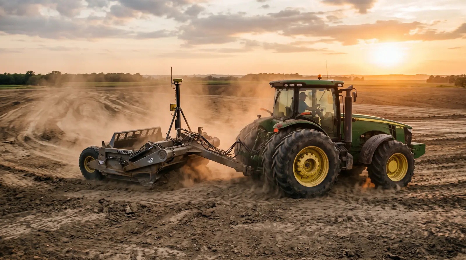
GPS land leveling reshapes a field to a planned grade so water drains one way instead of pooling. That wet spot is not a technology problem, it is a grade problem: the pocket is flat or falls the wrong way, so water has nowhere to run. The fix is a gentle, continuous, one-way fall held precisely across the field.
That fall is smaller than most people expect. On deep alluvial soils, the target row-direction slope is between 0.1 and 0.5 percent, with no reverse grade anywhere in the field (University of Missouri Extension, G1641). A tenth of a percent is about one foot of drop over a thousand feet. That is enough to move water. The entire job of precision grading is holding that tiny slope steady across the whole field instead of letting it wander into flat spots and back-slopes where the water stops. The pond in the back forty is exactly where that continuous fall breaks down.
Here is the reframe that saves people money and heartache: land leveling is not one job, it is three. Vendors blur them into one word and then sell you the shiny part. Kept separate, the three jobs are the survey, the design, and the grade control on the machine. Get the first two right and the third is almost a formality. Skip them and no amount of satellite hardware will save you.
Think of it as measure, plan, build.
The survey measures the dirt you already have, precisely, either with an RTK-GPS topo grid walked or driven across the field or with a drone flying LiDAR or photogrammetry. You cannot design a grade for ground you have not measured.
The design is the planned grade surface: a uniform fall in that 0.1 to 0.5 percent band, no reverse grade, with cut and fill balanced so the dirt roughly works out.
The grade control is the hardware on the scraper that actually builds the design, either a laser holding one reference plane or an RTK-GPS system following a digital surface.
The most common mistake in every article written about this topic is treating "GPS land leveling" as a single gadget you bolt on and drive. The GPS box is job three. Jobs one and two are where the work is won or lost, because the machine can only build the surface the survey and the design hand it. A perfect grade-control system building a bad design just gives you a very precise mistake.
Tight. The construction tolerance for land grading is plus or minus 0.1 foot at any point on the grid (MU Extension G1641). That is roughly three centimeters. If your survey of the existing ground is looser than the surface you are trying to build, the design sits on sand from the start. This is why survey quality is load-bearing, and why grade-control hardware exists at all: an operator eyeballing a blade cannot hold a tenth of a foot across a field, and neither can a survey done with a hand level and good intentions.
You have two honest ways to get the topo. A ground RTK-GPS grid survey walks or drives the field collecting elevation points, and it is the traditional, dependable method. A drone LiDAR survey builds a point cloud of the existing ground from the air, typically around 2 to 3 centimeters of vertical accuracy, and it can see the dirt through light vegetation because the laser pulses find gaps in the canopy. RTK or PPK drone photogrammetry, which builds elevation from overlapping photos instead of a laser, lands nearer 5 to 8 centimeters and struggles anywhere a canopy hides the ground, because a camera cannot photograph dirt it cannot see. Those figures are industry typicals, not guarantees, so treat them as ranges.
Either method can feed the grading design. The rule that matters is simple: the survey has to be at least as tight as the roughly 0.1-foot build tolerance, or the design is built on bad numbers. LiDAR is a way to get the survey. It is not the machine that moves dirt, and it does not level anything by itself.
The survey does one more thing that pays for it immediately: it reveals how many cubic yards you would have to move. That number drives both the cost and the risk, which is why the survey should come before the argument about the bid, not after.
Less than people think, and consistency beats steepness every time. The target on deep alluvial soils is a uniform fall of 0.1 to 0.5 percent in the row direction, with no reverse grade (MU Extension G1641). On prairie claypan soils the standard allows steeper grades, up to 1.0 percent, and the reason is important: steeper fall lets you move less dirt and avoid exposing large areas of subsoil. The grade allowance exists to protect the topsoil, not to drain faster.
The design also has to balance cut and fill. In practice that runs about a 1.30 to 1.50 cut-to-fill ratio, meaning you cut 1.3 to 1.5 yards for every yard of fill to cover losses from compaction, hauling, and undercutting. The dirt does not go one for one. That ratio, multiplied by the volume the survey found, is most of your cost.
Now the discipline that separates a good design from an expensive one: move the least dirt that kills the wet spots and gives you fall, not the flattest possible plane. A perfect table-top field is not the goal. Aggressive cuts strip topsoil off the high ground and expose infertile subsoil, and that ground can yield poorly for years. Sometimes the right answer is not a full reform at all but land smoothing, which shaves the high spots and fills the lows with far less earthmoving. If your problem is a few irregular pockets rather than a field that drains the wrong way, smoothing may solve it for a fraction of the cost.
This is the decision people get wrong most often, usually because they are sold a millimeter contest instead of a capability question. The two systems solve different problems.
| Laser grade control | RTK-GPS (3D) grade control | |
|---|---|---|
| How it works | A rotating transmitter projects one reference plane; a receiver on the scraper reads beam height and trims the blade | Reads the machine's satellite position against a loaded digital design surface |
| Grade it can build | One flat or uniform slope | Variable and compound grades |
| Line of sight | Required between transmitter and receiver | Not required |
| Day or night, dust or fog | Needs the beam | Works day or night, no beam to block |
| Best for | Single-plane fields, tight budget | Fields needing variable grades or too big for one beam |
A laser holds a very tight vertical plane over its line of sight, and for a field that only needs one slope it is often the cheaper, tighter, entirely correct choice. What it physically cannot do is build a grade that changes across the field, and it stops working the moment something blocks the beam.
RTK-GPS trades a hair of raw vertical tightness for the ability to build any surface, anywhere, without line of sight, in the dark or the dust. Vendors will tell you GPS is "as accurate or more accurate" than laser, quoting 10 to 15 millimeter vertical figures. Treat that as a vendor claim, not neutral fact. The defensible statement is this: buy GPS for what shape the field needs, not for a spec-sheet millimeter war. If the field needs a single plane and the beam reaches, a laser is the honest, cheaper answer. If the field needs variable grades, or it is too big for one beam, or you want to run at night, that is when GPS earns its price. The RTK backbone driving that grade control is the same one behind RTK-GPS guidance and auto-steer, so a farm already running RTK has part of the puzzle in place.
Sometimes clearly, sometimes not, and the honest answer depends entirely on your field and how you irrigate it.
On flood and furrow-irrigated ground, the benefit is best documented. Arkansas zero-grade rice research reports precision leveling cutting irrigation water use on the order of 10 to 15 percent versus conventionally leveled fields, along with fewer and straighter levees and less area lost to them. Grade that as directional: the figure comes from secondary summaries, it is specific to flood-irrigated rice, and no single percentage transfers cleanly to your field. On rain-fed row-crop ground, do not expect "water saved." The payoff there is drainage, trafficability, and uniform emergence: a field that dries in time for spring work, corners you can actually cross, and a stand that comes up evenly because no part of it drowned.
Cost scales with the dirt you move. Illustrative figures in circulation run roughly 100 to 600 cubic yards moved per acre at something like $1.15 to $1.50 per cubic yard, very roughly $150 to $500 or more per acre to start. Those are aggregator and contractor estimates, not quotes, and they swing hard with region, haul distance, and volume. The useful takeaway is not the dollar figure, it is the mechanism: cost follows cubic yards, and the survey tells you the cubic yards before you commit. That is another reason to pay for the survey first.
And the real cost is not only money. Deep cuts that expose subsoil can depress yield for years, which is exactly why the standards allow steeper grades on claypan to avoid it. On any cut of consequence, topsoil should be stripped and stockpiled, then spread back, not buried. A field that drains beautifully but grows poorly is not a win.
Yes, and this is the step most people skip. Before you design a single deep cut, you want to know how much topsoil sits over the restrictive subsoil layer, because that number decides whether an aggressive grade is smart or self-defeating. Pull the soil profile for the field first. Our free Soil Profile Quicklook tool draws the NRCS soil-survey data for any polygon you outline, so you can see depth to subsoil before you design cuts, not after you have already exposed it. It costs nothing and it can talk you out of an expensive mistake.
Surface grading is also only half of the drainage picture. Where the problem is water sitting below the surface as much as on it, subsurface tile drainage with smart controls is the complementary fix, and the two work together: shape the surface so water runs off, tile the ground so it drains down. Pairing them with broader water-management technology is how a wet field becomes a workable one.
Before any of this, call your local NRCS office. Precision land forming is a defined federal conservation practice: Precision Land Forming and Smoothing (Code 462), reshaping fields to planned grades to improve surface drainage and control erosion where depressions, mounds, old terraces, and turnrows interfere with drainage (USDA NRCS). Related standards cover Irrigation Land Leveling (464) and the lighter-touch Land Smoothing (466). These practices can carry EQIP cost-share, which means part of the bill may not be yours. It is a free phone call that can change the math on the whole project, so make it before you write a check, not after.
Match the tool to the shape the field needs. Pay for the survey first, because it prices the whole job and tells you how much subsoil you are about to disturb. Move the least dirt that kills the wet spots and gives you fall. Use a laser when the field needs one plane and the beam reaches, and GPS when it needs variable grades, no line of sight, or a field bigger than one beam. Check the soil before you cut, and call NRCS before you buy. Do that, and the pond that should not be there stops coming back.
GPS land leveling uses RTK satellite positioning to guide a scraper as it reshapes a field to a planned grade surface. The system reads the machine's exact position against a loaded digital design and trims the blade automatically, building a gentle one-way fall, usually 0.1 to 0.5 percent, so water drains uniformly instead of pooling. It works day or night and can build variable grades a laser cannot.
Neither is simply better; they solve different problems. A laser holds one very tight reference plane cheaply, but needs line of sight and can only build a single slope. RTK-GPS builds variable and compound grades, works with no line of sight, day or night, but costs more. Choose a laser for single-plane fields and GPS when the field needs variable grades or is too large for one beam.
On deep alluvial soils, aim for a uniform fall of 0.1 to 0.5 percent in the row direction with no reverse grade anywhere. That is as little as one foot of drop over a thousand feet. On prairie claypan soils, steeper grades up to 1.0 percent are allowed, mainly to move less dirt and avoid exposing subsoil. Consistency matters more than steepness; the wet spot is where the fall breaks down.
Cost scales with the cubic yards of dirt moved, so it varies widely by field, region, and haul distance. Illustrative estimates run roughly 100 to 600 cubic yards per acre at about $1.15 to $1.50 per yard, or very roughly $150 to $500 or more per acre. These are estimates, not quotes. A topo survey reveals the actual volume, and NRCS EQIP cost-share may cover part of the bill.
Yes, if you cut too aggressively. Deep cuts strip topsoil off high ground and expose infertile subsoil, which can depress yield for years. That is why conservation standards allow steeper grades on some soils, specifically to avoid exposing subsoil. Move the minimum dirt that kills the wet spots and gives you fall, strip and stockpile topsoil on deep cuts, and check depth to subsoil before designing the grade.
Join our list for practical guides on farm tech, precision agriculture, and tools that work.